
Southport Pier Radar
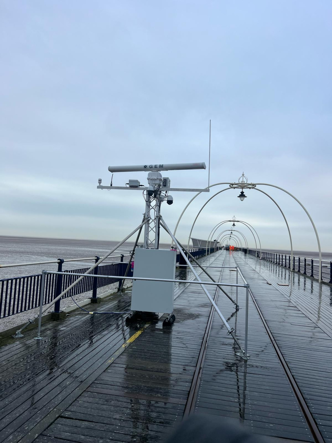
Many people will have seen the radarspining around on the closed Southport Pier. Here is the scientific explanation.
The radar is looking for backscatter off water, specifically waves and tidal extents, from this data can be derived topography and bathymetry (height of the seabed and beach/mud flats), surface currents and some wave information. The benefit of this system is that it continuously captures information and we can almost get a full new dataset every 2 week period. The radar has a radius of 4km. Its funded through the north west regional coastal monitoring programme.
The data will help us understand how the coast and estuary is changing and evolving.
The concept was developed by National oceanographic centre and developed as a survey system by Marlan Maritime Ltd, a SME in Liverpool.
Pic Qolcal.co.uk