Storm Betty Set to Bring High Winds and Heavy Rain to UK Coastal Areas

Met Éireann have named Storm Betty as a low-pressure system which is also triggering Met Office warnings.
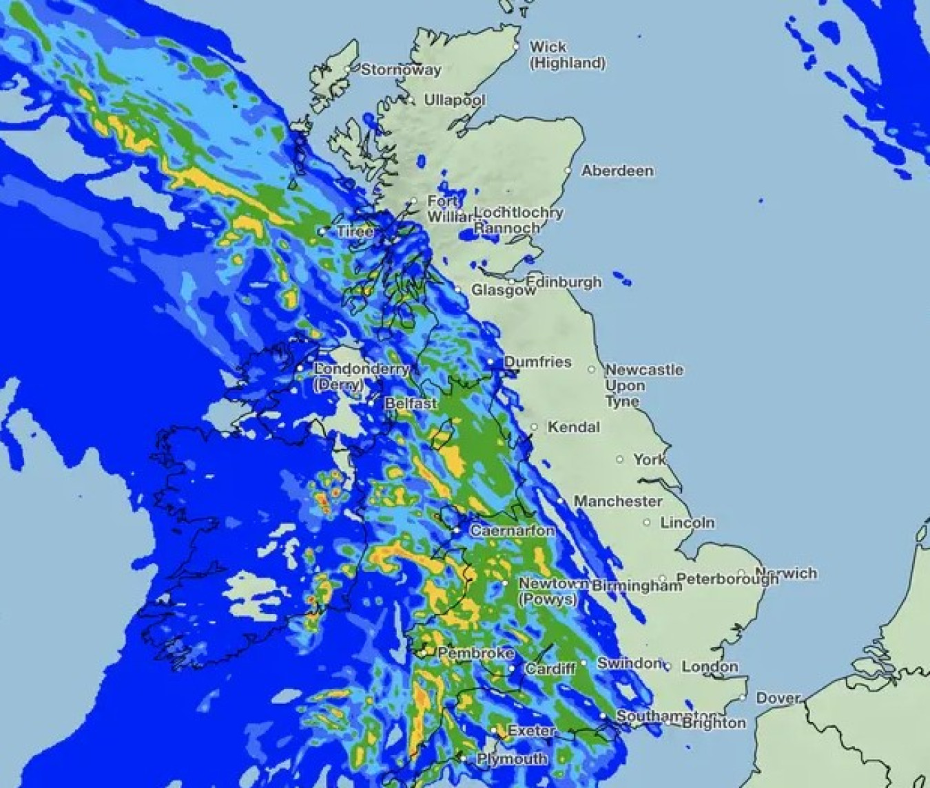
Storm Betty, which will bring higher impacts to the Republic of Ireland, will move from the south of Ireland to the north on Friday and into Saturday. It will bring some impacts to western areas of the UK in particular, with high winds and heavy rain likely for many.
A Met Office yellow warning for wind covers coastal areas of western Wales, eastern Northern Ireland and parts of northwest England and southwest Scotland. Rain warnings have also been issued from late Friday and into Saturday for Northern Ireland and parts of Scotland.
Met Office Chief Meteorologist Jason Kelly said: “Friday and Saturday will see unseasonably wet and windy conditions for much of the UK. While Storm Betty will have higher impacts in Ireland, exposed Irish Sea coasts of the UK could see gusts in excess of 70mph, with around 50mph more widely.
“Storm Betty is also bringing some large accumulations of rainfall for the time of year, with some spots of Northern Ireland seeing around 80mm of rain, though between 15-25mm is expected more widely. Parts of Scotland could see similarly high accumulations, especially over higher ground.”
Betty is the second storm named by the storm naming group of Met Éireann, the Met Office and KNMI following Storm Antoni earlier in August. This is the second time since storm naming was introduced in 2015 that two storms have been named in August, following Ellen and Francis in August 2020.
People living or working on the coast should take extra care during windy and stormy weather. To keep yourselves and others' safe, check the forecasts and tides in your local area here.
Thundery elsewhere
Friday and Saturday will also see thunderstorms develop in southern and eastern areas of England. Successive warnings have been issued with some impactful thunderstorms possible for some on Friday and into Saturday.
Jason added: “While many within the thunderstorm warning areas may see relatively little rainfall, there is the potential for a few places to see around 20-40mm of rain within an hour, and possibly around 40-60mm over three hours. Large hail and frequent lightning are additional hazards for the likely overnight thunderstorms in eastern areas of England.”
Be prepared for weather warnings to change quickly: when a weather warning is issued, the Met Office recommends staying up to date with the weather in your area.
Further ahead
Saturday will see the remnants of Storm Betty move north and leave behind some showers in western areas of the UK, though western Scotland will hold on to more persistent rain through the day.
The set up for Sunday and next week is for sunshine and showers to be the main theme of the forecast, with a westerly weather regime for the UK. Northern and western areas will see the most-frequent showers early next week, whereas further south and east there will be fewer showers and more in the way of sunshine, and it will feel warm here at times too.
