
Yellow Weather Warning issued by Met Office for thunderstorms this weekend
A Yellow Weather Warning has been issued for thunderstorms by the Met Office, as a plume of warm air will raise temperatures and increase the risk of thundery showers.
The high pressure area which has been responsible for the last couple of weeks of settled weather for much of the UK will drift away towards Scandinavia, allowing a plume of warm air from the south to influence the weekend weather for much of the UK.
This transition in the weather will begin late on Thursday for those in the southwest, with warm air from the south allowing for higher temperatures on Friday as well as a chance of the odd showery outbreak in the far southwest. This warmer air pushes further north and east through the weekend, with the possibility of more widespread showers bringing the chance of hail and gusty winds for a few places.
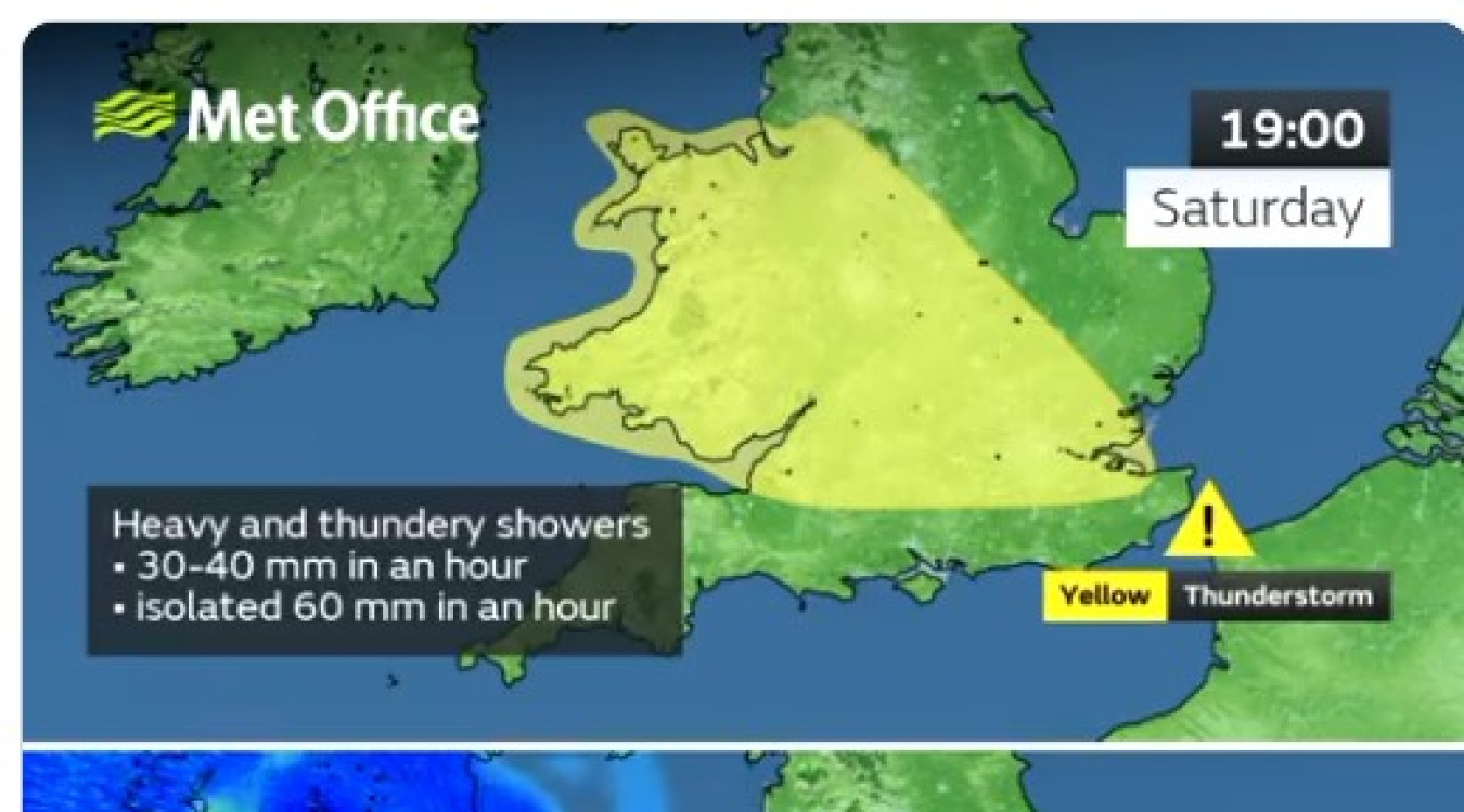
A Yellow Warning for thunderstorms has been issued, covering Wales and a large area of southern and central England from 1400 to 2100 on Saturday. The warning highlights potential disruption to travel, the chance of power cuts and the possibility of very localised flooding from the heaviest showers.
Met Office Deputy Chief Meteorologist Dan Harris said: “Although a plume of warm air will bring temperatures up to around 30°C in some parts of England, it brings with it the risk of some impactful thunderstorms. The general focus area for Saturday has become better defined over the past 24 hours, which has resulted in sufficient confidence to issue a “Very Low Likelihood” Yellow Thunderstorm Warning.
“While not everyone in the warning area will see the heaviest showers, or even showers at all, some are likely to be torrential and thundery, with 30-40mm falling in an hour. Some spots affected by multiple showers could see in excess of 60mm within the warning period. It’s worth noting that this far from the event the main focus area could change as latest forecast information becomes available, so it’s important to stay up to date with the latest forecast.
“It’s also important to note that this warmer air will also see relatively high night-time temperatures, often staying in the mid-teens Celsius for some.”
Storm Oscar, which has been named by the Spanish Meteorological Service (AEMET), will not be impacting the UK, though will help to drive the warm plume of air into southern areas.
East and northeast Scotland are likely to be the main exception to the change in conditions, with an easterly breeze possibly keeping temperatures more subdued with cloud likely to persist for some. Some coastal areas will be cooler than the peak figures further inland, with sea breezes preventing the highest temperatures building on immediate coastlines.